Our Forecast area

Our Forecast area
Wednesday, July 25, 2012
Severe thunderstorm is no more for some of the area, see below
Severe thunderstorm watch has been cancelled for all of my MN Counties except for Houston County. The severe thunderstorm watch is still in effect for all og my IA Counties, and most of my WI Counties.Until 1 AM.
Sunday, July 22, 2012
2012 heat so far.
Once again here is more info to bebunk some info we have seen.This comes from the NWS.
http://www.crh.noaa.gov/news/display_cmsstory.php?wfo=arx&storyid=85515&source=0
This is some of the info you will see on the NWS link above. So once again we bring you the fact not the BS.
http://www.crh.noaa.gov/news/display_cmsstory.php?wfo=arx&storyid=85515&source=0
This is some of the info you will see on the NWS link above. So once again we bring you the fact not the BS.
|
|
| 100 Degree Frequency | Average Per Year | 2012 So Far | 2011 Total |
| La Crosse, WI | 0.5 | 3 | 1 |
| Rochester, MN | 0.4 | 0 | 1 |
| Austin, MN | 0.0 | 0 | 1 |
| Winona, MN | 0.2 | 1 | 0 |
| New Hampton, IA | 0.6 | 0 | 0 |
| Charles City, IA | 0.6 | 0 | 0 |
| Lancaster, WI | 0.5 | 0 | 0 |
| Mauston, WI | 0.3 | 3 | 0 |
| Medford, WI | 0.3 | 0 | 0 |
The real deal with the July 18th severe storms plus other stuff
Ok here is the real deal with the severe storms that hit parts of my FA.
Map below is from the NWS showing warnings that they issued and storm reports.

Map below is from the NWS showing warnings that they issued and storm reports.

Here is the text reports.
NATIONAL WEATHER SERVICE LA CROSSE WI
639 PM CDT WED JUL 18 2012
..TIME... ...EVENT... ...CITY LOCATION... ...LAT.LON...
..DATE... ....MAG.... ..COUNTY LOCATION..ST.. ...SOURCE....
..REMARKS..
1258 PM HAIL HAYFIELD 43.89N 92.85W
07/18/2012 M1.50 INCH DODGE MN TRAINED SPOTTER
0151 PM HAIL 2 NE DEXTER 43.74N 92.67W
07/18/2012 M0.88 INCH MOWER MN TRAINED SPOTTER
0158 PM TSTM WND GST 1 W GRAND MEADOW 43.71N 92.59W
07/18/2012 E50.00 MPH MOWER MN TRAINED SPOTTER
0227 PM HAIL 1 S RACINE 43.76N 92.48W
07/18/2012 E0.75 INCH MOWER MN TRAINED SPOTTER
DIME SIZED HAIL
0227 PM TSTM WND GST 1 S RACINE 43.76N 92.48W
07/18/2012 E50.00 MPH MOWER MN TRAINED SPOTTER
0245 PM TSTM WND DMG SPRING VALLEY 43.69N 92.39W
07/18/2012 FILLMORE MN EMERGENCY MNGR
TREE BRANCHES UP TO 8 INCHES IN DIAMETER DOWN. LOCALIZED
STREET FLOODING.
0250 PM TSTM WND DMG SPRING VALLEY 43.69N 92.39W
07/18/2012 FILLMORE MN EMERGENCY MNGR
SIX THREE FOOT DIAMETER TREES DOWN. PARK PAVILION AND
APARTMENT BUILDING DAMAGED.
0254 PM TSTM WND GST 5 W PRESTON 43.67N 92.18W
07/18/2012 M49.00 MPH FILLMORE MN AWOS
0324 PM HAIL 3 W FREDERICKSBURG 42.96N 92.26W
07/18/2012 E1.50 INCH CHICKASAW IA PUBLIC
0327 PM TSTM WND GST HARMONY 43.56N 92.01W
07/18/2012 M53.00 MPH FILLMORE MN FIRE DEPT/RESCUE
0328 PM HAIL RIDGEWAY 43.30N 91.99W
07/18/2012 E1.75 INCH WINNESHIEK IA PUBLIC
0340 PM TSTM WND DMG HESPER 43.48N 91.79W
07/18/2012 WINNESHIEK IA LAW ENFORCEMENT
TREES DOWN IN TOWN.
0345 PM TSTM WND DMG 2 S HIGHLANDVILLE 43.42N 91.68W
07/18/2012 WINNESHIEK IA PUBLIC
CORN BENT OVER AND SEVERAL TREES UPROOTED.
0345 PM HEAVY RAIN 1 N CRESCO 43.39N 92.12W
07/18/2012 M1.20 INCH HOWARD IA CO-OP OBSERVER
RAIN AMOUNT IN 45 MINUTES.
0350 PM TSTM WND DMG 1 N DECORAH 43.32N 91.79W
07/18/2012 WINNESHIEK IA PUBLIC
LARGE TREE UPROOTED.
0400 PM TSTM WND GST DECORAH 43.31N 91.79W
07/18/2012 E50.00 MPH WINNESHIEK IA PUBLIC
0401 PM TSTM WND GST 4 N CALMAR 43.24N 91.87W
07/18/2012 M65.00 MPH WINNESHIEK IA CO-OP OBSERVER
0406 PM TSTM WND DMG DORCHESTER 43.47N 91.52W
07/18/2012 ALLAMAKEE IA CO-OP OBSERVER
BARN DESTORYED. TIME ESTIMATED FROM RADAR.
0410 PM TSTM WND GST 1 NW WAUKON 43.28N 91.49W
07/18/2012 E50.00 MPH ALLAMAKEE IA PUBLIC
SOME CORN BENT OVER.
0414 PM TSTM WND GST 4 E NORDNESS 43.23N 91.70W
07/18/2012 M53.00 MPH WINNESHIEK IA DEPT OF HIGHWAYS
0415 PM TSTM WND DMG WEST UNION 42.96N 91.81W
07/18/2012 FAYETTE IA EMERGENCY MNGR
A FEW TREES DOWN AND POWER LINES DOWN
0415 PM TSTM WND GST DORCHESTER 43.47N 91.52W
07/18/2012 E45.00 MPH ALLAMAKEE IA CO-OP OBSERVER
COUPLE OF 6 INCH DIAMETER TREE BRANCHES DOWN.
0420 PM HEAVY RAIN DECORAH 43.31N 91.79W
07/18/2012 M1.50 INCH WINNESHIEK IA PUBLIC
HOUR RAINFALL TOTAL.
0445 PM FLASH FLOOD 2 N LYNXVILLE 43.28N 91.05W
07/18/2012 CRAWFORD WI LAW ENFORCEMENT
ROCK SLIDE ONTO HWY 35 NORTH OF LYNXVILLE.
0445 PM TSTM WND DMG FERRYVILLE 43.34N 91.08W
07/18/2012 CRAWFORD WI LAW ENFORCEMENT
TREES AND POWER LINES DOWN AROUND FERRYVILLE.
0445 PM TSTM WND DMG RICHLAND CENTER 43.34N 90.38W
07/18/2012 RICHLAND WI AMATEUR RADIO
5 INCH DIAMETER BRANCHES DOWN AT 4TH AND CEDAR.
0448 PM HAIL 1 SW MOUNT IDA 42.96N 90.77W
07/18/2012 E0.25 INCH GRANT WI LAW ENFORCEMENT
0450 PM HEAVY RAIN MONONA 43.05N 91.39W
07/18/2012 M1.75 INCH CLAYTON IA PUBLIC
HALF HOUR RAINFALL TOTAL.
0450 PM TSTM WND DMG SENECA 43.27N 90.97W
07/18/2012 CRAWFORD WI LAW ENFORCEMENT
REPORTS OF TREES POWER LINES DOWN ACROSS CRAWFORD COUNTY.
LOCATION ESTIMATED FROM RADAR.
0450 PM HEAVY RAIN BURR OAK 43.45N 91.88W
07/18/2012 M1.75 INCH WINNESHIEK IA BROADCAST MEDIA
HOUR RAINFALL TOTAL.
0455 PM TSTM WND GST PRAIRIE DU CHIEN 43.04N 91.14W
07/18/2012 M52.00 MPH CRAWFORD WI AWOS
0501 PM TSTM WND DMG PRAIRIE DU CHIEN 43.04N 91.14W
07/18/2012 CRAWFORD WI LAW ENFORCEMENT
TREES AND POWERLINES DOWN.
0512 PM TSTM WND GST PRAIRIE DU CHIEN 43.04N 91.14W
07/18/2012 M72.00 MPH CRAWFORD WI PUBLIC
MATURE TREES DOWN IN PARTS OF TOWN.
0512 PM TSTM WND GST BOSCOBEL 43.14N 90.70W
07/18/2012 M48.00 MPH GRANT WI ASOS
0530 PM TSTM WND DMG RICHLAND CENTER 43.34N 90.38W
07/18/2012 RICHLAND WI PUBLIC
LARGE TREES 3 FEET IN DIAMETER SNAPPED OFF 8 TO 12 FEET
ABOVE THE GROUND.
0530 PM FLOOD VIROQUA 43.56N 90.89W
07/18/2012 VERNON WI TRAINED SPOTTER
SOME STREET FLOODING AROUND TOWN.
0533 PM TSTM WND DMG RICHLAND CENTER 43.34N 90.38W
07/18/2012 RICHLAND WI LAW ENFORCEMENT
TREES DOWN IN THE CITY. ALSO OTHER TREES DOWN IN THE
COUNTY. TIME ESTIMATED VIA RADAR.
Could someone tell me what a "very severe squall line" is I never in my life heard of that in the training I have in weather.Also I sure don't see any funnels that were reported, unlike that one blog is saying. More BS.
Another thing whew it is sure hot out there temps well into the 90s. NOT. Only 84 the highest temps is 86 in Down town Rochester. So SE MINNESOTA BUST WEATHER BLOG LIVES UP TO IT'S NAME ONCE AGAIN.
Below is our fast cast for temps through next week and weekend.
Low 90s to middle 90s for Monday. The rest of the week Middle 80s for our highs.Monday will be our last day we see the 90s. By Next weekend temps could be in the upper 70s to lower 80s.
Tuesday, July 10, 2012
Welcome
I would like to take this time to welcome all our new viewers from the other blog. Thanks for all the emails you all sent into us, makes us know we are doing our forecasts and reports like everyone of you want.There is NO BS on this blog just the hard cold facts. Also you will see if temps or whatever is corrected by the NWS we will update out report to reflect it. We we here at Weather 4 You look forward to bring you the best in weather forecasting and our reports. We have the latset tech stuff that we know the other blog doesn't have and can't get! Another reason why Weather 4 You is for YOU!
We will be the best forecast blog in this area. We may not update out forecast everyday unless things really change.
Once again thanks to all the new viewers!
We will be the best forecast blog in this area. We may not update out forecast everyday unless things really change.
Once again thanks to all the new viewers!
Monday, July 9, 2012
Dry weather ahead this week
Nice long road of dry weather ahead for this week and
lasting into the weekend. The area does need some rain, as drought conditions
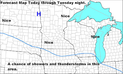
keep becoming stronger with each passing day. The only areas to see rain would well north of my forecast area, and so far that looks slim to none.However like last week models showing about the same things as far as precip goes, so I had to add the chance in on the map below.This may end up changing to a dry forecast up there as well.

Temps will slowly warm from the lower 80s to around 90 by
Friday and holding either side of 90 for the weekend.


Sunday, July 8, 2012
Past heat wave facts!
Have added in some of the temps that were corrected by the NWS after my report was issued.
I also added in La Crosse temps throughout the heat wave, this will also show everyone it was cooler in the Rochester metro area than other places!
La Crosse temps....
July 2nd. 99
July3rd. 99
July 4th. 103
July 5th. 98
July 6th. 103.
July 7th. 85
I also added in La Crosse temps throughout the heat wave, this will also show everyone it was cooler in the Rochester metro area than other places!
I went ahead and did this report on my own since The Weather
Center is being a butthead!
I will talk about a lot of things, However you will notice I’m
not going to run with maps, I’m going to give you the right information on this
heat wave!
This information is only for the city of Rochester.
There was a long lasting heat wave that started back on July
first and lasted through July 6th. Most days it was warmer up to the
North I will talk about that later.
Time to look at what the high temps were….
June 30th .High was 88.Don’t think the heat wave
started then!
July 1st. High was 91.
July 2nd. High was 92.
July 3rd . High was 90.Corrected temp to 93
July 4th . High was 93.
July 5th. High was 93.Correceted temp to 94
July 6th . High was 95. Corrected temp to 96
July 7th . High was 84. The heat wave broke this
day.
My sky watchers across the Rochester metro are reported
temps in the lower to middle 90s also. No 100s!!
Now if one wanted to find 100 degree temps one could find
them at other sites like The Weather Channel and underground weather, weather
bug. We all know they are wrong as they do a general over all view of the
temps.
We did not tie or break in record highs in the Rochester
metro area. The information below is to debunk some other info I have read.
What was interesting about this heat wave.
1 The days it lasted. Also this was not the longest heat
wave for the area. We need to look back to the 1911 year and also the 1936s.
1936 was the worst year on record that I could find. So just ask some of the
old people around and they will tell you about the dust bowl days.
2 the higher dewpoints we had with this heat wave. Dps where
in the 70s.
3 wasn’t much wind to help make it feel cooler.
4 was no showers and
storms to help cool the temps down a little in the late night hours and early morning
hours.
5 it was warmer north of the area. From Red Wing to La
Crosse and north of that line to Pine City MN to around the Hayward WI area.
Time to talk about that.
The Twin Cites metro area…Below is a report from the Minnesota
Climatology Working Group
A History of 100
Degrees in the Twin Cities
For the second time in a week, the
mercury hit 100 degrees or higher at the Twin Cities International Airport. The
last time there were two 100 degree maximum temperatures in the Twin Cities was
1988, when there were four.
July 1-6, 2012 will also finish the
warmest first six days of July on record in the Twin Cities with a preliminary
average of 87 degrees F, higher than the next closest average (July 1-6 1949)
with 84.2 degrees F.
It's been relatively uncommon to see
the mercury reach 100 at the Twin Cities International Airport in recent years.
Before 2011, the last time the maximum temperature was 100 degrees or more was
on July 31, 2006 when the air temperature reached was 101 degrees. Looking back
to 1873, the maximum temperature at the Twin Cities official measuring site has
reached 100 or more on 64 occasions. The most was in 1936 with nine days. The
last year with more than one 100 degree temperature was in 1988 with four.
Below is a table of all the dates
since 1873 of days where the temperature was 100 or more at the offical Twin
Cities observing site.
Year Month Day Precip High Low Average
1883 7 1 0 100 72 86
1894 7 11 0 100 71 86
1894 7 26 0 100 75 88
1901 7 20 0 102 76 89
1901 7 23 0 101 74 88
1901 7 24 0 101 67 84
1913 8 15 0 100 74 87
1926 7 16 0 102 68 85
1931 6 28 0 102 82 92
1931 6 29 0 102 83 93
1931 6 30 0 100 82 91
1931 7 15 0 101 77 89
1931 7 16 0 100 80 90
1931 7 27 0 104 80 92
1931 9 10 0 104 75 90
1932 7 20 0.02 101 74 88
1933 6 19 0 100 75 88
1933 7 30 0 100 78 89
1934 5 31 0 106 75 91
1934 6 27 0 104 70 87
1934 7 21 0 105 73 89
1934 7 22 0 105 71 88
1934 7 23 0 105 80 93
1936 7 6 0 104 69 87
1936 7 7 0 101 80 91
1936 7 8 0 101 82 92
1936 7 10 0 106 80 93
1936 7 11 0 106 82 94
1936 7 12 0 106 83 95
1936 7 13 0 105 86 96
1936 7 14 0.04 108 72 90
1936 8 15 0.44 103 70 87
1937 7 10 0 100 76 88
1940 7 18 0 101 68 85
1940 7 19 0.02 100 76 88
1940 7 22 0 103 74 89
1940 7 23 0 103 75 89
1941 7 23 0 100 74 87
1941 7 24 0 104 76 90
1947 8 4 0 102 76 89
1947 8 5 0 100 78 89
1947 8 10 0 101 75 88
1947 8 17 0.28 100 72 86
1948 7 6 0 101 75 88
1949 7 3 0 100 79 90
1949 7 4 0 100 75 88
1955 7 26 0.08 100 73 87
1955 7 28 0 100 72 86
1956 6 13 0 100 77 89
1974 7 8 0 101 73 87
1976 7 13 0 100 69 85
1977 7 19 0 100 79 90
1980 7 11 0.3 100 72 86
1982 7 5 0 100 78 89
1985 6 8 0 102 64 83
1988 6 24 0 101 70 86
1988 7 15 0.06 102 79 91
1988 7 31 0 105 72 89
1988 8 1 0 101 74 88
1990 7 3 0 100 72 86
1995 7 13 0 101 75 88
2006 7 31 0.09 101 80 91
2011 6 7 0 103 78 91
2012 7 4 0 101 81 91
2012 7
6 0 102
78 90*
*as of 5pm July 6
Once again we see that the year 1936
was the hottest summer on record.
Let us look at Rice Lake WI.
The official highs.
The 3rd and 5th
saw highs of 88. With The Weather Centers observers reporting upper 80s to a few
lower 90s.
July 2nd Rice Lake broke
their old record of 93 with an official temp of 95. Some of The Weather Center’s
observers reported a few upper 90s. as well as their office. Also EAU set a
record of 99 that broke the 1911 record of 98….. SO as one can see this day was
warmer than the Rochester metro area.
July 4th saw another hot
day up North. The official high for Rice Lake was 95.This tied the record of 95
that was set in 1972. Many of The Weather Center’s observers reported temps
hitting the 100 degree mark, Their office also hit 100.
Once again this day was warmer up
north than in the Rochester metro area.
July 6th was still a hot
day with official temp of 91 while some of The Weather Center’s sites reported
middle 90s.
July 1st was also warmer
up north than in the Rochester metro area. Temps in the middle to upper 90s up
in Rice Lake,WI.
La Crosse temps....
July 2nd. 99
July3rd. 99
July 4th. 103
July 5th. 98
July 6th. 103.
July 7th. 85
There you have the facts on this
heat wave, there was no adding to them to make us look better. Just the hard cold
facts.
Monday, July 2, 2012
Record highs up in WI
Eau Claire and Rice Lake set new record highs for today.
See The Weather Center's page for more data, as they just posted it! Rice Lake is warmer than we are down here in Rochester that is unreal!
See The Weather Center's page for more data, as they just posted it! Rice Lake is warmer than we are down here in Rochester that is unreal!
Temp map
Forgot to add this map.This shows what I discued below. So don't let others fool you with fake reports.
My weather spotters in Rochester are all reporting low 90s 91 to 92.

My weather spotters in Rochester are all reporting low 90s 91 to 92.

Warmer up North
Once again today its warmer up north and east of Rochester.
The temps at 4 PM is 92.
The Cities coming at 98.
Eau Claire WI 98.
LA Crosse 98.
Decorah IA 93.
This is strange how this has been playing out over the last few days. Warmer north a little cooler south.
The temps at 4 PM is 92.
The Cities coming at 98.
Eau Claire WI 98.
LA Crosse 98.
Decorah IA 93.
This is strange how this has been playing out over the last few days. Warmer north a little cooler south.
Current conditions as of 11 AM
Here are the Current Conditions at 11:00 am.
In Rochester temps are rather the same. Middle 80s My
weather spotters are also reporting middle 80s across the city.
Dewpoints are in the upper 60s to lowers 70s making heat
indexs around the 90 degree mark.
Over in La Crosse we seem temps in the lower 90s already,
with a heat index of 97. Boscobel
reporting a temp of 94, with a heat index of 101.
Thinking is these is where we will see the warmer temps
today, over my WI Counties,and into my IA Counties.
No severe weahter for the area
Some talk about severe thunderstorms for the area today and tonight. Well thats all it is, just talk.
Here is our severe thunderstorm threat area, as you can see the best chances will be along and north of the warm front.
Also see The Weather Center's discussion on this threat and their update on the heat wave.
Here is their link.This can also be found on the right.
http://dirksforecastingcenter.blogspot.com/
Their discussion on this heat wave may pan out. I do have to agree with their thinking.
Here is our severe weather threat map.

Subscribe to:
Posts (Atom)